Heavy Snow Expected This Weekend in Glacier Park
Montana experienced warm temperatures today, but a shift to cooler weather is expected this weekend with heavy snow forecasted for Glacier National Park. A winter storm watch is in effect, with significant snowfall and rain predicted in various areas. Temperatures are set to drop dramatically by Sunday.
MONTANA – Today, temperatures in Montana soared into the mid-70s to mid-80s, bringing delightful warmth across the state. The sky was mostly clear, though a few thunderstorms did pop up near the Canadian and North Dakota borders in the far northeast. Winds were mild, generally between 5 to 15 mph, with stronger gusts up to 30 mph reported in Jordan, creating a lovely spring day overall. High pressure has been the key player behind this pleasant weather.
However, changes are on the horizon as a moist southwest flow is set to return to the state tomorrow. This shift will bring the potential for afternoon thunderstorms, particularly in the southwestern regions, where some storms might be on the stronger side. Most areas throughout the state should get ready for showers and similar storm activity on Friday as this pattern unfolds.
Looking ahead to this weekend, a trough of low pressure is on its way from Seattle, which will cool things down significantly. Saturday will see much cooler temperatures in the western part of Montana, and statewide, Sunday will bring even colder conditions. Tourists heading to Glacier National Park should prepare for unexpected weather changes, as heavy snow is forecasted in the park.
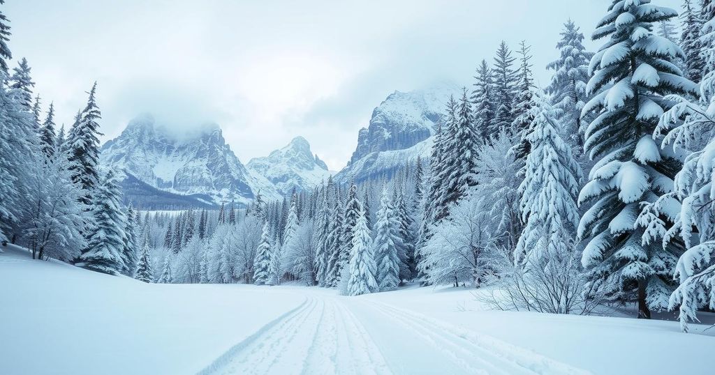
A winter storm watch has been issued for Glacier National Park, scheduled from Saturday afternoon through Sunday morning. The forecast indicates that elevations above 6,000 feet could see up to a foot of snow, impacting areas like Logan Pass, while lower elevations around 4,000 feet may receive around four inches. Additionally, heavy rain is anticipated with the storm’s arrival in northwest Montana, with predictions of two to four inches in Flathead and Lincoln Counties.
For tonight, temperatures are expected to dip into the upper 40s to mid-50s. Tomorrow we can expect highs to reach between mid-80s and mid-90s, though a sharp drop in temperatures is anticipated by Sunday, with highs dropping to the 50s and 60s.
In summary, Montana is currently enjoying warm spring weather, but a significant shift is coming this weekend with cooler temperatures and the potential for heavy snow in Glacier National Park. Tourists should remain aware of the winter storm watch; preparation is essential given the forecasted conditions. As the week progresses, rain and thunderstorms are also expected, marking a change from the sunny, warm days observed recently.
Original Source: www.montanarightnow.com


