Chances for Tropical Storm Nadine Diminish as NHC Lowers Odds for Invest 94L Formation
Chances for Tropical Storm Nadine to develop continue to decrease, as the National Hurricane Center lowers the odds for Invest 94L formation. A second disturbance in the western Caribbean may cause rainfall, but risks remain low for Florida. Strong wind shear is expected to disrupt any tropical development heading towards the southeastern United States, while the Atlantic coast might face rough surf and coastal flooding.
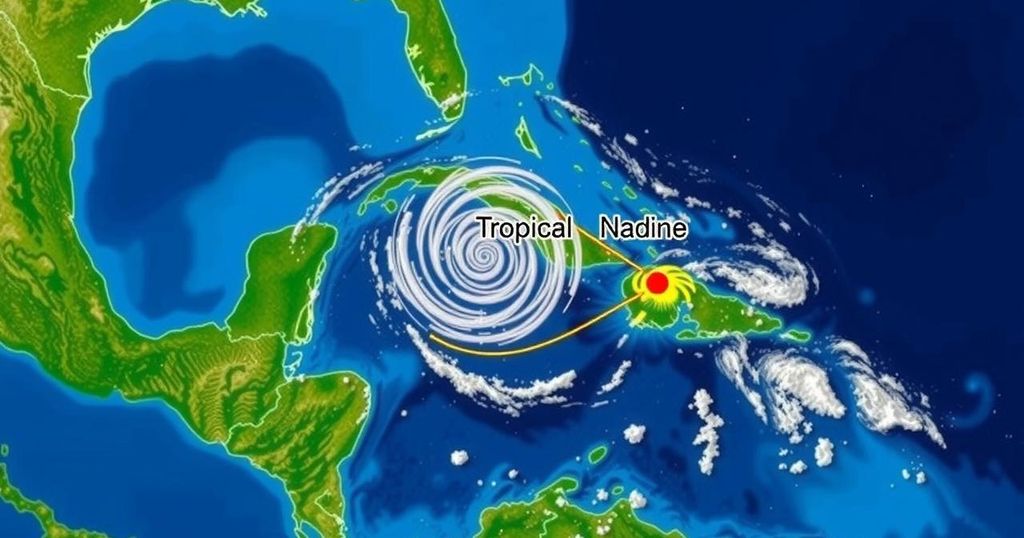
The National Hurricane Center (NHC) has significantly diminished the prospects for the formation of Tropical Storm Nadine, thereby providing a sense of relief to residents of Florida monitoring the situation. Over the past week, the NHC has focused on two tropical disturbances in the Atlantic Ocean and the western Caribbean Sea. Initially, Invest 94L, located in the Atlantic, appeared to be the prime candidate for transforming into Tropical Storm Nadine, the next storm in the naming sequence. However, the NHC has steadily downgraded its development potential throughout the week. The western Caribbean disturbance may develop slightly in the coming days but is expected to ultimately move inland into Central America, bringing substantial rainfall to the area and southern Mexico over the upcoming weekend. Fortunately, Florida is unlikely to experience impacts from either system due to strong wind shear, which meteorologists at AccuWeather anticipate will disrupt and likely disintegrate any tropical developments headed towards the southeastern United States. Currently, Invest 94L remains a disorganized area of low pressure producing scattered showers and thunderstorms a few hundred miles east of the Leeward Islands. As this system moves westward at a pace of approximately 20 mph, it is anticipated to approach Puerto Rico and the Virgin Islands on Friday, and will subsequently pass near Hispaniola and the southeastern Bahamas on Saturday. Nevertheless, strong upper-level winds are expected to inhibit any further development by the end of the weekend. In relation to the western Caribbean disturbance, it originated from a gyre in the region and is forecasted to see minimal development before making landfall in Central America. Currently, the system has a mere 20% chance of becoming a tropical storm. Regardless of its trajectory, remnants of this wave are likely to result in heavy localized rains across parts of Central America and southern Mexico. Despite the calmness in the tropics, residents of Florida’s Atlantic coast are advised to remain vigilant. AccuWeather indicates that persistent northeast winds could lead to rough surf, excessive tides, and a risk of coastal flooding and beach erosion. Coastal cities like Miami, known for experiencing flooding during high tide events, may also face significant street flooding as a result of overwash from these maritime conditions.
The seasonal shift in the tropics often invokes vigilance among residents in hurricane-prone regions such as Florida. As the Atlantic hurricane season progresses, the National Hurricane Center actively monitors various disturbances, providing crucial updates regarding their development potential. Understanding the dynamics of these disturbances, such as Invest 94L and other systems in the Caribbean, is vital for assessing risks and preparing adequately for potential impacts, including heavy rainfall and coastal hazards.
In summary, the chances of Tropical Storm Nadine forming from Invest 94L have dwindled considerably, with the NHC highlighting significant wind shear that will likely inhibit development. While the western Caribbean disturbance may yield some rainfall upon moving into Central America, Florida appears secure from major impacts based on current forecasts. Residents along the Atlantic coast are, however, advised to prepare for rough seas and potential flooding due to surging tides and rip currents.
Original Source: www.pnj.com


