Severe Winter Storm to Disrupt Midwest and Northeast Travel
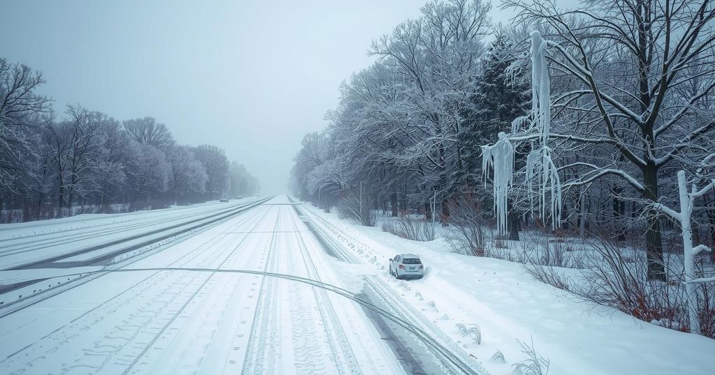
A severe winter storm is forecasted to spread across the Midwest and Northeast from February 5-6, bringing snow, ice, and potential power outages. Hazardous travel conditions are anticipated, particularly in metropolitan areas like Chicago and Cleveland. After this storm, another system is expected over the weekend, creating similar issues.
A significant winter storm is forecasted to impact the Midwest and Northeast regions from February 5-6, bringing hazardous travel conditions due to snowfall, sleet, and freezing rain. Affected areas may experience power outages as freezing rain accumulates on trees and power lines amid subsequent windy conditions. As this storm progresses, it will bring varying precipitation types, leading to severe disruptions, especially in transportation and local power supplies.
Snowfall will begin accumulating in states such as Montana and the Dakotas, then shift eastward through parts of the Great Lakes and into northern Michigan. The storm is expected to affect southern Canada and parts of New England, with the highest snowfall likely in mountainous regions. Meanwhile, southern areas will see rain and potential thunderstorms, which may produce hail and gusty winds.
Ahead of the storm, cold air in the Midwest is expected to combine with moisture, resulting in significant ice and sleet in regions including northeastern Indiana and northern Ohio. AccuWeather Meteorologist Brandon Buckingham indicated that major cities like Chicago and Cleveland are at risk for hazardous ice accumulation, which could interrupt travel particularly on key interstates.
In the I-95 corridor, snowfall may be minimal, but certain areas could experience at least an inch of snow as the storm approaches Wednesday night. This precipitation will heavily depend on temperature fluctuations, which Buckingham noted could result in snow for New York City during the Thursday morning commute. Temperatures are projected to rise throughout Thursday, potentially melting any snowfall before the storm moves out to the New England coast.
As thunderstorms develop across the Tennessee Valley on Wednesday afternoon, there could be significant hail risk moving north into Kentucky and Tennessee. While most activity will remain south of the Ohio River, cities like Nashville should remain vigilant as storms advance. Behind the storm, strong winds up to 40 mph are predicted, potentially creating visibility issues due to blowing snow.
Following this storm, meteorologists anticipate another system to impact the Northeast soon, likely bringing additional snow, ice, rain, or thunderstorms over the weekend. These upcoming storms may follow a similar pattern of hazardous winter weather as the initial system. The AccuWeather app offers real-time alerts for users to stay informed about severe weather risks.
This article discusses an impending winter storm set to affect various states across the Midwest and Northeast of the United States, detailing the types of precipitation expected and the associated risks for travel and power outages. It highlights the specific regions that will experience hazardous conditions, emphasizing the importance of awareness and preparation during severe winter weather events.
In summary, a significant winter storm is projected to bring dangerous conditions across the Midwest and Northeast, potentially resulting in travel disruptions and power outages due to ice accumulation and strong winds. Immediate impacts include hazardous travel on major roadways and the likelihood of subsequent storms following closely. Residents are advised to remain informed and cautious during this severe weather period.
Original Source: www.accuweather.com


